- Chronology
- Before 1500 BCE
- 1500 BCE to 500 BCE
- 500 BCE to 500 CE
- Sixth to Tenth Century
- Eleventh to Fourteenth Century
- Fifteenth Century
- Sixteenth Century
- Seventeenth Century
- Eighteenth Century
- Nineteenth Century
- Twentieth Century
- Twenty-first Century
- Geographic Area
- Africa
- Caribbean
- Central America
- Central and North Asia
- East Asia
- North America
- Northern Europe
- Oceania/Australia
- South America
- South Asia/South East Asia
- Southern Europe and Mediterranean
- West Asia
- Subject, Genre, Media, Artistic Practice
- Aesthetics
- African American/African Diaspora
- Ancient Egyptian/Near Eastern Art
- Ancient Greek/Roman Art
- Architectural History/Urbanism/Historic Preservation
- Art Education/Pedagogy/Art Therapy
- Art of the Ancient Americas
- Artistic Practice/Creativity
- Asian American/Asian Diaspora
- Ceramics/Metals/Fiber Arts/Glass
- Colonial and Modern Latin America
- Comparative
- Conceptual Art
- Decorative Arts
- Design History
- Digital Media/New Media/Web-Based Media
- Digital Scholarship/History
- Drawings/Prints/Work on Paper/Artistc Practice
- Fiber Arts and Textiles
- Film/Video/Animation
- Folk Art/Vernacular Art
- Genders/Sexualities/Feminisms
- Graphic/Industrial/Object Design
- Indigenous Peoples
- Installation/Environmental Art
- Islamic Art
- Latinx
- Material Culture
- Multimedia/Intermedia
- Museum Practice/Museum Studies/Curatorial Studies/Arts Administration
- Native American/First Nations
- Painting
- Patronage, Art Collecting
- Performance Art/Performance Studies/Public Practice
- Photography
- Politics/Economics
- Queer/Gay Art
- Race/Ethnicity
- Religion/Cosmology/Spirituality
- Sculpture
- Sound Art
- Survey
- Theory/Historiography/Methodology
- Visual Studies
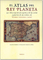
One of the joys of archival research is making a discovery. Would that everyone’s could be as significant as the recovery by Felipe Pereda and Fernando Marías of a manuscript atlas of maps and bird’s-eye views of the entire coast of Spain assembled between 1622 and 1634 by the Portuguese cartographer, Pedro Teixeira (alternately, Texeira as used in the volume under review). The atlas survives at the Österreichische Nationalbibliothek in Vienna, home also to the impressive collection of views of Spanish cities made for Philip II between 1562 and 1570 by another foreign subject of the Spanish court, the Flemish painter Anton van den Wyngaerde (see Richard Kagan, ed., Spanish Cities of the Golden Age, Berkeley: University of California Press, 1992; Spanish edition, Madrid: El Viso, 1991). The publication of Wyngaerde’s views in the early 1990s served as a jolt to Spanish architectural history, inspiring new research on cities as diverse as Córdoba, Medina del Campo, and Madrid. The volume under review here—equally stunning in its completeness and resulting visual impact—may do the same for the history of Spanish cartography.
El Atlas del Rey Planeta includes an introductory essay and four chapters, followed by a beautiful color facsimile of the atlas and a fifty-eight-page transcription of a written report that was meant to accompany it. Teixeira’s maps and city views are the heart of this book, both figuratively and literally. The atlas occupies one hundred and seventy-four pages of this richly produced volume. Teixeira’s original vellum manuscript is composed of eighty-seven folios with one hundred and two painted images, and measures approximately thirty-five by forty-four centimeters. Most of the maps and views include place names as well as the identification of major waterways, but some remain unlabeled. A few pages of the manuscript with large, elaborate cartouches were clearly meant for text that was never added.
The atlas opens with a luxurious depiction of the Spanish Habsburg arms, a dedication page, and a two-folio map (“tabla general”) of Spain. This is followed by twelve maps of provinces interspersed with eighty-eight bird’s-eye views of principal ports, beaches, and naturally fortified areas. The sequence moves the viewer from the westernmost extreme of Spain’s northern coast counterclockwise to the province of Catalonia and the border with France, itself represented in a separate map. To close the atlas, the cartographer includes a spectacular mappamundo, making the allusion to the worldwide reach of the Spanish Habsburg monarchy. Although it seems evident that Teixeira would have relied on pre-existing maps in drawing his maps of provinces, the bulk of the work for the atlas remains original. The cartographer’s written report—which survives in three copies in London, Madrid, and Vienna—is filled with evidence of the empirical nature of this undertaking, leading Pereda to conclude that the atlas was “the most important geographic enterprise in the whole of Philip IV’s reign” (29).
An introductory essay by Pereda and Marías provides the most complete biography that exists for Teixeira (born in Lisbon, c. 1595; died in Madrid, 1662). Teixeira is most famous for his monumental map-view of Madrid of 1656, but he printed his earliest work as royal cosmographer in 1621. The atlas allows for an understanding of Teixeira’s interim activity for the court of Philip IV, and cements his reputation among the leading artist-scientists of his day. Moreover, Pereda and Marías argue that Teixeira’s manuscript should be read in conjunction with the Spanish Habsburg pretension to be dominators of the world as suggested in the appellation Rey Planeta (“Planet King”) used for Philip IV at court, though not by Teixeira in the atlas. With possessions on the four known continents and all of them represented in Teixeira’s mappamundo, Pereda and Marías make the convincing argument that the atlas is a physical manifestation of Spanish political ideals of the 1630s.
Chapter 1, Pereda’s “An Atlas of the Coasts and Cities Painted for Philip IV,” outlines the scope of Teixeira’s project. Pereda argues that the atlas had a political and military significance. That is, it served as a tool to represent the richness of Spanish ports and coastal cities, but also to help plan for the defense of these places from foreign powers. Moreover, Pereda views the atlas as evidence of the scientific research carried out at the Academia de Matemáticas, established in Madrid by Philip II and home to luminaries such as Teixeira’s mentor and fellow royal cosmographer, João-Baptista Lavanha. In the essay, Pereda also speculates on the nature of Teixeira’s expedition, which was composed of two parties and must have included a considerable number of individuals, with measuring equipment and supplies that allowed them to navigate Spain’s extensive coastline. Pereda’s essay yields valuable insight into the multiple facets of the project—historical, geographical, and cartographic. Some of the research is based on new archival documents, and much derives from a careful reading of Teixeira’s written report meant to accompany the atlas. Pereda ends the chapter by questioning why the atlas remained incomplete, and offers a date of 1634 as the year in which Teixeira stopped working on it for reasons still unknown.
Richard Kagan’s chapter on “Maps, Science and Power at the Court of Philip IV” is a masterful essay on the importance of maps as symbols of authority at the Spanish Habsburg court. The chapter opens with a vivid picture of the Royal Alcázar in Madrid, and describes walls lined with maps, topographical views, and cartographic texts as evidence of Philip IV’s keen interest in geography. Kagan goes on to explain the concept of a Planet King as a reflection of Philip’s geocentric education, an education that was quite extensive according to the author, despite earlier conclusions by scholars. Kagan also ventures an answer to the question of why Teixeira’s atlas remained unfinished, attributing the mystery to the “inherent secrecy of official, state sponsored cartography” (63). The historical context—specifically, pressures on the monarchy from Richelieu and the Dutch in the early 1630s—rendered the atlas top secret and thus off-limits to a printer’s hands if, indeed, it was ever intended for publication.
The third chapter, Agustín Hernando’s “Power, Cartography, and the Politics of Secrecy in Seventeenth-Century Spain,” picks up many of the themes explored by Pereda and Kagan. The essay reads a bit repetitively in parts, but also offers some of the only descriptive passages in the book. For example, Hernando discusses building types represented in the city views, as well as features such as the vegetation of the surrounding countryside and coastline. Frustratingly, the author’s descriptions are not illustrated, and so the reader must flip through the facsimile looking for a visual corollary. Hernando’s effort to challenge Teixeira’s sole authorship of the atlas seems futile. Admittedly, the notion of more than one hand at work is understandable given the cartographer’s almost certain use of previously published images for his maps of provinces. However, the overall consistency of the imagery—and correspondences with the three known printed maps by Teixeira—leaves little doubt about the creator of this important manuscript. Hernando ends his essay with a consideration of the mappamundo, offering a reading of the image as one of power. The author notes the presence of Spain’s chief territorial holdings in the middle of the map, with the Atlantic Ocean in a privileged position, but he does not take the observation any further to explore its representational meaning as other scholars working with maps, such as Ricardo Padrón or Michael Schreffler, have done recently.
In the fourth chapter, Marías’s “Images of Spanish Cities: From Cartographic Conventions to Urban Chorography” takes up themes worked out in conjunction with Kagan and published elsewhere (see most importantly, Kagan, with Fernando Marías, Urban Images of the Hispanic World, 1493–1793, New Haven: Yale University Press, 1999; Spanish edition, Madrid: El Viso, 1998). The chapter seeks to establish typologies that might be used in the study of Spanish cartography, and argues that city views should be read as artistic objects in and of themselves rather than as accurate representations of historic cities. The chapter is filled with interesting ideas about the making of maps and the debate about art versus science in early modern cartography, but only at the end does the essay turn to Teixeira’s atlas. Here, Marías argues very convincingly that, via a manipulation of scale and emphasis on topography, Teixeira sought to make his views representations of places capable of being experienced by the viewer.
In a final essay, entitled “The Key to the Atlas,” which immediately follows the facsimile, Daniel Marías offers a summary analysis of Teixeira’s written report, the Vienna copy of which is transcribed by Luis Zolle in the last portion of the book, immediately preceding a useful index. Marías dates the report to 1631–32, arguing that it must have been composed shortly upon Teixeira’s return to Madrid following his expedition. Speculating upon the sea and land routes taken by the cartographer and his team, as well as the instruments they used in carrying out their work, the essay concludes with a claim that Teixeira’s survey was far superior to anything then existing in Spain and would not be surpassed until the eighteenth century.
Despite the inclusion of a stunning facsimile of Teixeira’s work, El Atlas del Rey Planeta surprisingly lacks a careful visual analysis of the manuscript. A thorough discussion of one or two of the painted views would suffice to suggest ways in which the images—along with the written report—might lead to new discoveries in Spanish architectural and cartographic history. The task, however, is left to the reader/viewer. This is not necessarily a bad thing, but certainly a missed opportunity. As an example, the two-folio bird’s-eye view of the mouth of the river Tagus with Lisbon lording over it is spectacular. The theatricality of the view is clearly intentional, as Teixeira writes in his report, “Lisbon is one of the most important cities of Europe, and there is none in Spain that is comparable” (339). Likewise, as we hover over ships—what Teixeira calls “titans of grandeur” (monstruos de grandeza)—entering the Straits of Gibraltar with cannons firing, it seems rather clear that a desire for narrative seems to have guided Teixeira in part during his recording of life in the Spanish territories for his royal patron.
The richness of Teixeira’s manuscript will certainly inspire new research by local historians interested in Spanish coastal cities, by scholars concerned with a better understanding of the role of science at the court of Philip IV, and by those historians with a global vision of the Spanish Habsburg monarchy, as the scope of the atlas lends itself to such research. The editors, authors, and other members of the team who produced this volume are to be commended for this outstanding contribution to the history of Spanish cartography and urbanism, and for laying a groundwork for future historians.
Jesús Escobar
Department of Visual and Performing Arts, Fairfield University