- Chronology
- Before 1500 BCE
- 1500 BCE to 500 BCE
- 500 BCE to 500 CE
- Sixth to Tenth Century
- Eleventh to Fourteenth Century
- Fifteenth Century
- Sixteenth Century
- Seventeenth Century
- Eighteenth Century
- Nineteenth Century
- Twentieth Century
- Twenty-first Century
- Geographic Area
- Africa
- Caribbean
- Central America
- Central and North Asia
- East Asia
- North America
- Northern Europe
- Oceania/Australia
- South America
- South Asia/South East Asia
- Southern Europe and Mediterranean
- West Asia
- Subject, Genre, Media, Artistic Practice
- Aesthetics
- African American/African Diaspora
- Ancient Egyptian/Near Eastern Art
- Ancient Greek/Roman Art
- Architectural History/Urbanism/Historic Preservation
- Art Education/Pedagogy/Art Therapy
- Art of the Ancient Americas
- Artistic Practice/Creativity
- Asian American/Asian Diaspora
- Ceramics/Metals/Fiber Arts/Glass
- Colonial and Modern Latin America
- Comparative
- Conceptual Art
- Decorative Arts
- Design History
- Digital Media/New Media/Web-Based Media
- Digital Scholarship/History
- Drawings/Prints/Work on Paper/Artistc Practice
- Fiber Arts and Textiles
- Film/Video/Animation
- Folk Art/Vernacular Art
- Genders/Sexualities/Feminisms
- Graphic/Industrial/Object Design
- Indigenous Peoples
- Installation/Environmental Art
- Islamic Art
- Latinx
- Material Culture
- Multimedia/Intermedia
- Museum Practice/Museum Studies/Curatorial Studies/Arts Administration
- Native American/First Nations
- Painting
- Patronage, Art Collecting
- Performance Art/Performance Studies/Public Practice
- Photography
- Politics/Economics
- Queer/Gay Art
- Race/Ethnicity
- Religion/Cosmology/Spirituality
- Sculpture
- Sound Art
- Survey
- Theory/Historiography/Methodology
- Visual Studies
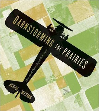
The role of modernity in influencing vision has produced such a wealth of insightful scholarship that it can be surprising when a new study contributes substantially to the field. Jason Weems’s Barnstorming the Prairies: How Aerial Vision Shaped the Midwest provides an engaging and thoughtful analysis of how the elevated vantage point helped to create the modern Midwestern landscape and, in turn, informed the region’s identity. Weems explores how the aerial, synoptic view of the prairie fostered changes in the perception of that landscape through a series of case studies beginning with the piecemeal pioneer settlement of individual farms that took shape along government survey lines in the early nineteenth century to Frank Lloyd Wright’s vision of a new relationship with the land in his plans for Broadacre City. The aerial view enabled federal, state, and local governments as well as individuals to manage and control the Midwestern landscape; yet it also became a means for Midwesterners to craft an image of the region that merged the Jeffersonian ideal of the yeoman farmer with the changes wrought by modernity. The airplane, in particular, prompted a new way for Midwesterners and outsiders to understand the region, especially with the advent of aerial photography, which allowed farmers and government bureaucrats to not only understand the changes occurring in the region but also shape them.
Weems begins his study of aeriality, a term used repeatedly throughout the book, with the visual strategies developed in the nineteenth century to make sense of the seemingly featureless topography of the prairie. Spurred by Thomas Jefferson’s agrarian dream for the nation, government surveyors traveled westward to plat the land, creating an orderly network that encouraged settlement. As Weems rightly notes: “Overwriting the natural landscape with an abstract grid brought a measure of control over the land by retooling it through a universalizing framework that was stable, predictable, and, above all, useful to the expansion of American civilization” (17). The grid provided for the efficient sale and settlement of land. Map making, with its lofty perspective and abstract rendering of the topography, not only assisted in that expansion but also helped to define the visual character of the Midwest as settlers began to farm sections, creating the patchwork of individual farms still associated with the region. By the turn of the twentieth century, bird’s-eye lithographic views and illustrated atlases proved more popular as tools for encouraging civic pride, conveying progress, or blatantly exaggerating a community’s growth. Regardless of the intention, the aerial view played a fundamental role in developing the image and the mythology of the Midwest as the agricultural heart of the nation.
With the advent of the airplane, aerial photography helped both farmers and the government to survey the landscape and ultimately establish a better understanding of the particularities of the topography. Aerial photographs assisted in the spread of the New Deal land management policies, furthered the documentary aims of the Farm Security Administration’s (FSA) Historical Section, and provided journalistic flair for popular magazines such as Life. Weems acknowledges that the aerial view was often a means for the government both to control the landscape and its image and to encourage common agricultural and cultural practices across the Midwest. Aerial photography aided government agents in demonstrating to individual farmers the relationship between their farms and the broader rural landscape, with the intention of creating greater efficiency, unifying individual agricultural production for the national good, and ending the environmental abuses that produced the Dust Bowl. The grid that had served so usefully in the settlement of the broad sweep of the prairie carried little information as to the specific features of the land, and aerial photography provided valuable information about contours and drainage that might increase yield or prevent field degradation. In this respect, the objectives of government agents were largely benign, and farmers frequently embraced aerial photography for its utility and sometimes as an expression of pride in their land. The FSA photography of Arthur Rothstein and John Vachon, while concerned principally with the aesthetics of the modern agricultural landscape and the efficacy of government programs, offered individual viewers a novel view of the Midwest. The aerial view was not merely a means for government bureaucrats to exercise control over the individual farms but an intermediary between farmers and the government, allowing the former greater agency in the changes occurring across the Midwestern agricultural landscape.
For the artist Grant Wood, those changes and the aerial views that helped to impel them became an abiding interest in the 1930s. Weems explores how Wood adopted the perspectives of nineteenth-century bird’s-eye views and illustrated atlases, while also acknowledging modern aerial photography, as a means of integrating the older, nostalgic views of agrarian communities with the changes brought by modernity. Wood, like so many Midwesterners, felt ambivalence and, at times, anxiety over the toll modernity might take on rural communities. This is visible especially in paintings such as Stone City, Iowa (1930), which bears numerous similarities to Alfred T. Andreas’s views of the town in his 1875 Illustrated Historical Atlas of the State of Iowa. Beholden in part to a historic representation, Stone City, Iowa is somewhat anachronistic in its view of the town, which is conceived as still largely agrarian. Despite the presence of billboards, the only visible mode of transportation is equine, not automotive. The wages of modernity became more obvious to Wood as the 1930s progressed, and he responded with paintings such as Death on Ridge Road (1935), in which modernity intrudes into the otherwise peaceful countryside with fatal implications. Wood used the aerial view not as a celebration of the virtues of agrarian life but as a critique of the changes occurring on the prairie. Despite Wood’s suspicion of modernity, his images of the changing Iowan countryside provided Midwesterners an additional strategy for adapting to those changes.
Frank Lloyd Wright, by contrast, sought to temper modernity with a new approach to urban planning. In his 1932 book The Disappearing City (New York: William Farquhar Payson), Wright laid out plans for the utopian community Broadacre City. Aeriality helped Wright to envision a new city, unifying rural, agrarian spaces with the urban and industrial. He opposed the congestion, centralization, and verticality of the city in favor of a horizontal, rectilinear plan that emphasized a direct relationship to the land. The concept anticipated suburbia in some respects by devoting significant parcels of land within the city to agricultural and other green spaces. Wright rejected traditional urbanism and adapted the Jeffersonian ideal for modern civilization. Though Broadacre City would remain a utopian fantasy, Wright continued to revise his plan until his death in 1959, and the aerial vision that had been used since the nineteenth century to shape perceptions of the Midwest was instrumental in refining his ideas for the later designs published in When Democracy Builds (Chicago: University of Chicago Press, 1945) and The Living City (New York: Horizon Press, 1958) as well as the model he created with his students at Taliesin West.
Wright’s desire to unify the rural and urban came to fruition, albeit in a considerably different form, with the spread of suburban America following World War II. Suburban life represented a modern adaptation of the Jeffersonian notion, allowing individuals to pursue democratic self-determination through land ownership. As rural communities began to shrink after the war, suburbs flourished, and the dominance of the Midwestern grid was gradually supplanted by the curves of suburban planning. Aeriality continued to shape the perception of the Midwest, though it often took the form of satellite photography or Geographic Information System computer modeling of crop yields.
Throughout Barnstorming the Prairies, Weems draws upon a diverse array of sources from American visual culture. Wood, Wright, Rothstein, and Vachon figure most prominently in the argument, but Mickey Mouse and MGM’s The Wizard of Oz (1939) provide support to Weems’s examination of aeriality. Though the aerial view is frequently understood as a means of authoritative control, the book offers a far more nuanced interpretation of how this form of vision shaped the landscape and character of the Midwest. Weems deviates from that familiar argument of authoritative control to rightly note that aerial vision was more egalitarian than previous studies have suggested. His conclusion that an aerial view helped to define the iconography of the Midwest and furthered the expression of self-determination derived from Jeffersonian idealism demonstrates that Midwesterners did enjoy some agency in fashioning their regional identity, even when confronted with the uncertainties of modernity.
Mark White
Wylodean and Bill Saxon Director, Fred Jones Jr. Museum of Art, University of Oklahoma