- Chronology
- Before 1500 BCE
- 1500 BCE to 500 BCE
- 500 BCE to 500 CE
- Sixth to Tenth Century
- Eleventh to Fourteenth Century
- Fifteenth Century
- Sixteenth Century
- Seventeenth Century
- Eighteenth Century
- Nineteenth Century
- Twentieth Century
- Twenty-first Century
- Geographic Area
- Africa
- Caribbean
- Central America
- Central and North Asia
- East Asia
- North America
- Northern Europe
- Oceania/Australia
- South America
- South Asia/South East Asia
- Southern Europe and Mediterranean
- West Asia
- Subject, Genre, Media, Artistic Practice
- Aesthetics
- African American/African Diaspora
- Ancient Egyptian/Near Eastern Art
- Ancient Greek/Roman Art
- Architectural History/Urbanism/Historic Preservation
- Art Education/Pedagogy/Art Therapy
- Art of the Ancient Americas
- Artistic Practice/Creativity
- Asian American/Asian Diaspora
- Ceramics/Metals/Fiber Arts/Glass
- Colonial and Modern Latin America
- Comparative
- Conceptual Art
- Decorative Arts
- Design History
- Digital Media/New Media/Web-Based Media
- Digital Scholarship/History
- Drawings/Prints/Work on Paper/Artistc Practice
- Fiber Arts and Textiles
- Film/Video/Animation
- Folk Art/Vernacular Art
- Genders/Sexualities/Feminisms
- Graphic/Industrial/Object Design
- Indigenous Peoples
- Installation/Environmental Art
- Islamic Art
- Latinx
- Material Culture
- Multimedia/Intermedia
- Museum Practice/Museum Studies/Curatorial Studies/Arts Administration
- Native American/First Nations
- Painting
- Patronage, Art Collecting
- Performance Art/Performance Studies/Public Practice
- Photography
- Politics/Economics
- Queer/Gay Art
- Race/Ethnicity
- Religion/Cosmology/Spirituality
- Sculpture
- Sound Art
- Survey
- Theory/Historiography/Methodology
- Visual Studies
The Beinecke Map forms part of the large corpus of maps and manuscripts created by native painter scribes, or tlacuiloque, in colonial Mexico as records of indigenous land property and to support land claims. Painted on fig-bark paper (amate), the map measures approximately six feet long by three feet wide and renders a small, unidentified area of Mexico City. Utilizing the image of a black rectangular grid divided into 121 fields that take up most of the map, it offers a detailed register of the plots of land owned by natives. Placed clearly inside each one of these divisions is a pictographic representation of the landholders and their name glyphs. To the left of these plots, the artists painted images of the five native governors who ruled the city from 1538–65, as well as that of Viceroy Don Luis de Velasco. Their presence seems to suggest a connection between these powerful political figures and the smallholders depicted on the map, a common issue addressed by native pictorials from this period. The Beinecke Map was painted in the 1560s by a group of at least six different artists. It is now part of the collection of the Beinecke Rare Book and Manuscript Library at Yale University, which acquired it in 1975 from the book collector William Reese, then an undergraduate student of the college. It is not listed in any of the main catalogues of colonial manuscripts (i.e., John Glass in volume 15 of the Handbook of Middle American Indians [Austin: University of Texas Press, 1975]) and had never been published or received much scholarly attention until now.
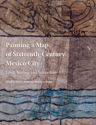
Painting a Map of Sixteenth-Century Mexico City offers a compelling study of the Beinecke Map. Edited by Mary E. Miller and Barbara E. Mundy, the book brings together an international group of scholars from different fields. Their collective research results in what Miller refers to as a “biography” of the Beinecke Map. In many ways, Painting a Map of Sixteenth-Century Mexico draws attention to the map not only as a major colonial painting and historical document, but also as an object with a history of its own.
The book is divided into nine chapters that gradually introduce the reader to the map and its complexities. The first two chapters examine its iconography and physical properties, then frame it within the painting tradition from which it stems. These introductory chapters provide the reader with the necessary tools required to comprehend the images. The third chapter explores its relationship to another colonial map similar in content and form. Chapters 4 and 5 present the results of scientific analysis carried out on its support and pigments, with an emphasis on the symbolic meaning of the latter. Chapter 6 proposes a location for this map within Mexico City. The next chapter focuses on the lineages depicted and how artists highlighted them to justify land ownership. There is also a detailed study of the pictographic script, and a final chapter that traces the history of the Beinecke Map from sixteenth-century New Spain to twenty-first-century New Haven. The essays are consistently good. The book is also beautifully illustrated with high-resolution images of the Beinecke Map and other related pictorials. A gatefold at the end with a facsimile of the map makes it easy to study relevant details while reading the essays.
In line with recent literature on colonial maps and manuscripts, such as Cave, City, and Eagle’s Nest: An Interpretive Journey Through the Mapa de Cuauhtinchan No. 2 (Davíd Carrasco and Scott Sessions, eds., Albuquerque: University of New Mexico Press, 2007), the authors of Painting a Map of Sixteenth-Century Mexico City portray the Beinecke Map as a document that cleverly responds to the challenges brought to the native population after the Spanish conquest, that is, as an example of indigenous agency. Even if they do not come to a complete agreement regarding why the map was painted, the essays refer to it as part of the indigenous strategy to retain and preserve land in Mexico City. In the first of her two essays for the volume, Mundy demonstrates that native-made maps were indeed “important instruments for the indigenous government to protect all classes of lands against land-hungry Spaniards” (42). She frames these maps within the tlacuiloque tradition and then explains how maps were widely accepted as evidence by the Spanish bureaucracy. Mundy emphasizes that these visual representations of the land constituted a cultural space, mutually recognized by both Spaniards and natives, where they could communicate their ideas.
One of the book’s main contributions is its analysis of the Beinecke Map as a physical object with a history or “social life” of its own. The authors underscore that, as a document recording land ownership in times of change, its materiality, usage, and circulation disclose deeper meanings embedded on it. Scientific analysis of the map has revealed several palimpsests and additions; these show that the original document was heavily modified by at least six artists in the different stages of its use. In their respective essays, Dennis Carr, María Castañeda de la Paz, Diana Magaloni Kerpel, and Mundy discuss these major physical interventions and their relevance. Carr describes the amendments done to the left side of the map, particularly those concerning the ruler list. An unknown artist sliced off this section entirely to insert a twenty-centimeter strip of amate paper and thus widen the map (and perhaps the span of indigenous lands as well). In addition, several artists repeatedly modified the list of governors, sometimes adding paper overlays to the map, always adding new layers of meaning. These changes show the community’s need to keep the information about land ownership and rulership updated in the colonial period and offer clues to the history of the map’s use. The multiple diagrams and photographs that illustrate this excellent introductory essay allow the reader to understand the various sequences.
Castañeda de la Paz examines the ruler list and posits an explanation of the map’s pentimenti based on the history of Mexico-Tenochtitlan’s main dynasty. She analyzes comparatively the Beinecke Map and a contemporary, well-known plan called Plano Parcial de la Ciudad de México. Both maps depict an unidentified area of Mexico City, a detailed record of land plots, and a representation of various native rulers that indexes a connection between lineage and land tenure (although, significantly, the list is far from identical). Like the Beinecke Map, the ruler list in Plano Parcial was altered by at least three artists. Castañeda de la Paz argues that both documents were created to establish a connection between Don Luis de Santa María Cipactzin (Cipac), the last ruler depicted, and the former tlatoque of Tenochtitlan’s royal house. Cipac probably commissioned both manuscripts to demonstrate he descended directly from the lineage of the Aztec emperor Axayacatl. He needed this validation because during his reign (1563–65) it was not clear how he became governor. The maps thus corroborate his right to the patrimonial lands of the royal house, although each one uses distinct historical arguments to support this claim. In the colonial world, where Spaniards still respected some privileges of indigenous nobility, maps that documented dynastic regimes were of utmost importance for safeguarding property.
Mundy’s second essay also addresses issues of native authority and land tenure. She argues that by presenting native rulers in an ordered sequence and dressed in traditional regalia (xiuhuitzolli, tilmatli, and tepotzoicpalli), the artists of the Beinecke Map highlight the stability of this lineage in the midst of the grave 1560s crisis of authority that affected the viceroyalty. The map advocates for an indigenous government, one that allows them to distribute and protect land. The images of two non-Tenochca nobles, Luis de Velasco and Esteban de Guzmán, are of strategic importance as they indicate that the Spaniards validated this claim.
Until very recently, the study of colonial native maps and codices had seldom incorporated scientific analysis, but the major discoveries revealed in Painting a Map of Sixteenth-Century Mexico City raise awareness of its importance for academic research. Magaloni Kerpel put together a team of specialists to sample the Beinecke map’s pigments and amate fibers. According to Magaloni Kerpel, these studies show that to the tlacuiloque, “the image and the materials used to create it [the Beinecke Map] were linked and interdependent phenomena. . . . Colors that might appear equivalent to the naked eye were often composed of distinct materials and these were consciously used by the tlacuiloque to create images of things of differing natures, making the material itself part of the meaning” (76). When the Nahua painter-scribes referred to their manuscripts, they used the couplet “in tlilli in tlapalli,” which literally translates as, “the black ink, the colored pigments.” According to Magaloni Kerpel, this couplet is also a “metaphor for knowledge” and is reflective of the close link that exists between painting an image and providing some information about it. The artists of the Beinecke Map used two different pigments for the color red: cochineal and cinnabar. Cochineal comes from the female insect of the Coccus cacti and is part of the solar world in Nahua cosmogony. For this reason it was used to color the maize plants and cobs. Cinnabar, on the other hand, is a mineral obtained from below the earth’s surface, and so it was used to color other related elements such as the spondylous, an osseous thorny oyster shell that is part of Don Diego de San Francisco Tehuetzquititzin’s name glyph. These differences are only discernible through infrared reflectography, ultraviolet light analysis, and Fourier transform infrared spectroscopy. These studies contribute strongly to an understanding of the tlacuiloque painting tradition, as they uncover hidden and meaningful aspects. This work is closely related to another recently published book (to which Magaloni Kerpel also contributed): Colors Between Two Worlds: The Florentine Codex of Bernardino de Sahagún (Gerhard Wolf and Joseph Connors, eds., Cambridge, MA: Harvard University Press, 2012) (click here for review). Hopefully this kind of study will set the trend for future investigations of colonial manuscripts.
All the evidence indicates that the Beinecke Map gives a picture of Mexico City, but there are no place names or legible texts that accurately designate a specific area. Pablo Escalante Gonzalbo responds to the challenge and proposes a location for the map based on a meticulous analysis of the topography depicted and information culled from historical sources and other colonial maps such as Alzate’s Plano de la Ymperial México (1796). Escalante Gonzalbo describes the conflicts that arose between the Spanish cabildo (town council) and the indigenous communities for the arable lands on the eastern part of the city, next to the recently finished dike of San Lázaro. Escalante Gonzalbo posits that the map was created by members of the Atlixco neighborhood as part of these disputes. He suggests that the stone wall depicted on the Beinecke Map is the San Lázaro dike, and the small, black-and-white chapel painted on it is San Jerónimo, from Atlixco. He argues that there is no other part of the city that has a chapel built next to the San Lázaro dike.
Painting a Map of Sixteenth-Century Mexico is a major contribution to the study of native colonial maps. As a collective work of authors from different fields, it provides a broad, interdisciplinary perspective on the map, from its materiality to its writing system, iconography, and history. Because of its emphasis on the natives’ ability to negotiate visually with the Spaniards, this book has much to offer those interested in issues of native agency and the social role of art in Latin America. It will be valuable as well to studies on the history of the production, circulation, and uses of images because of its analysis of the Beinecke Map as a “historical character itself” (6).
Ana Pulido-Rull
Assistant Professor, Department of Art, University of Arkansas, Fayetteville