- Chronology
- Before 1500 BCE
- 1500 BCE to 500 BCE
- 500 BCE to 500 CE
- Sixth to Tenth Century
- Eleventh to Fourteenth Century
- Fifteenth Century
- Sixteenth Century
- Seventeenth Century
- Eighteenth Century
- Nineteenth Century
- Twentieth Century
- Twenty-first Century
- Geographic Area
- Africa
- Caribbean
- Central America
- Central and North Asia
- East Asia
- North America
- Northern Europe
- Oceania/Australia
- South America
- South Asia/South East Asia
- Southern Europe and Mediterranean
- West Asia
- Subject, Genre, Media, Artistic Practice
- Aesthetics
- African American/African Diaspora
- Ancient Egyptian/Near Eastern Art
- Ancient Greek/Roman Art
- Architectural History/Urbanism/Historic Preservation
- Art Education/Pedagogy/Art Therapy
- Art of the Ancient Americas
- Artistic Practice/Creativity
- Asian American/Asian Diaspora
- Ceramics/Metals/Fiber Arts/Glass
- Colonial and Modern Latin America
- Comparative
- Conceptual Art
- Decorative Arts
- Design History
- Digital Media/New Media/Web-Based Media
- Digital Scholarship/History
- Drawings/Prints/Work on Paper/Artistc Practice
- Fiber Arts and Textiles
- Film/Video/Animation
- Folk Art/Vernacular Art
- Genders/Sexualities/Feminisms
- Graphic/Industrial/Object Design
- Indigenous Peoples
- Installation/Environmental Art
- Islamic Art
- Latinx
- Material Culture
- Multimedia/Intermedia
- Museum Practice/Museum Studies/Curatorial Studies/Arts Administration
- Native American/First Nations
- Painting
- Patronage, Art Collecting
- Performance Art/Performance Studies/Public Practice
- Photography
- Politics/Economics
- Queer/Gay Art
- Race/Ethnicity
- Religion/Cosmology/Spirituality
- Sculpture
- Sound Art
- Survey
- Theory/Historiography/Methodology
- Visual Studies
The field of Roman cartography has undergone a renaissance in recent years. This is due not only to the publication of books like The Barrington Atlas of the Greek and Roman World (Richard J. A. Talbert, ed., Princeton: Princeton University Press, 2000), but also to a fundamental shift in how scholars understand the function of Roman maps. For decades, scholars assumed that the Romans used maps much like we do, as navigational aids to facilitate travel and warfare. This assumption, however, has proven to be both anachronistic and inaccurate. Unlike modern people, the Romans rarely used maps for navigation, instead preferring to get directions from local tour guides and itineraria, texts that listed names and distances between important stops on the Roman road system. The majority of Roman maps were, in fact, commissioned by wealthy aristocrats as decorative objects to display on public monuments. As Claude Nicolet has observed in Space, Geography, and Politics in the Early Roman Empire (Ann Arbor: University of Michigan Press, 1991), the primary function of these maps was not practical but, rather, ideological: they conveyed an idealized vision of how space should be organized under Roman rule. When viewed in this light, maps represent an invaluable tool for studying the visual development of Roman imperial ideology and its effects on the formation of identity in the Roman empire.
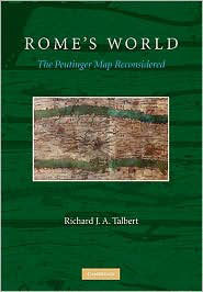
Richard Talbert, who is best known for editing the Barrington Atlas, has been a leading voice in the field of Roman cartography for over thirty years. His new book, Rome’s World, examines the so-called “Tabula Peutingeriana,” a medieval copy of a late Roman world map, named for its original owner, Konrad Peutinger. This map, which is preserved on a roll of parchment approximately 33 × 672 cm, depicts the Roman world as a long, slender strip of land, crisscrossed by an elaborate system of travel routes. Scholars have long speculated about the date and function of the Peutinger map, which has been variously identified both as a “Roman route diagram” and as a medieval mappa mundi. Through a careful reassessment of the evidence, Talbert argues that the Peutinger map is, in fact, an unrevised copy of a Roman world map originally used to decorate the throne room of a Tetrarchic palace like the one the emperor Diocletian built at Split, Croatia. In this context, the map’s primary function, according to Talbert, was to symbolize the reunification of the Roman empire under Diocletian at the very end of the third century CE.
The size and complexity of the Peutinger map have made it difficult to reproduce using lithography and photographs. As a result, scholars have traditionally had access to only a small number of accurate published drawings and photographs. Talbert makes it his main goal in Rome’s World “to render the [Peutinger] map more widely accessible and more comprehensible with the support of up-to-date scholarship and technology” (1). He solves the reproducibility problem by creating a website featuring, among other things, a full-color image of the Peutinger map created using digital photos taken in 2000 by the Austrian National Library. The interface allows users to scroll, zoom, and highlight key features, such as rivers and mountains; however, there is no way to save screen captures which may be disappointing to those who use PowerPoint for teaching. Talbert’s website also includes a commentary on place names and a database of travel routes cross-referenced with the Barrington Atlas. These new digital resources represent a valuable addition not only to Talbert’s book, but also to the study of Roman cartography in general.
In chapter 1, Talbert traces the history of the Peutinger map from its initial discovery in 1500 by Konrad Celtes up through the present day. Talbert reconstructs the map’s chain of custody in excruciating detail, as well as the conditions under which it was stored and displayed. He also conducts an exhaustive survey of all early scholarship on the map. He seems particularly interested in the work of scholars like Franz Christoph von Scheyb (1753) and Peter Katancsich (1824/5), whose contributions to the study of the Peutinger map have yet to be properly recognized. By contrast, Talbert barely addresses the work of contemporary scholars like Kai Brodersen and Benet Salway (71–72), which feels like a significant oversight (see, e.g., Kai Brodersen, Terra Cognita, Studien zur römischen Raumerfassung, Hildesheim: Georg Olms, 1995; and Benet Salway, “Travel, Itineraria and Tabellaria,” in Colin Adams and Ray Laurence, eds., Travel and Geography in the Roman Empire, New York: Routledge, 2001). Talbert is even-handed in his criticism, yet ultimately rejects all previous interpretations of the Peutinger map on the grounds that they are too “traditional” in approach. He is especially critical of Konrad Miller’s theory in Itineraria romana (1916) that the Peutinger map was a road diagram designed to guide Roman aristocrats on official business. As Talbert points out, the road network represented on the Peutinger map has too many gaps and inconsistencies to serve as a practical navigational tool. If a Roman did try to use this map to travel, she or he would surely get lost, which suggests that the map’s primary purpose lies elsewhere.
In chapter 2, Talbert investigates the “material aspects” of the Peutinger map in order to gain new insights into the processes that led to its production. Through his analysis, Talbert is able to confirm that the current version of the map was copied layer by layer, rather than pricked or traced directly over another copy. He also identifies a drafting line on the left margin, which confirms that this version of the map never extended further in that direction. By far the most important part of this chapter, however, is the section on paleography, which is co-authored by Martin Steinmann. Based on a careful examination of scripts and letterforms, Talbert and Steinmann conclude that the original exemplar of the Peutinger map goes back to late antiquity and that the extant copy was produced by a single artist sometime around 1200 CE, perhaps in the region of southern Germany or Alsace.
In chapters 3 and 4, Talbert addresses the unique design of the Peutinger map, which has baffled scholars for generations. Why would a Roman cartographer produce a map with such a strange, elongated appearance? One theory is that the Peutinger map was, in fact, originally much taller, but had to be compressed to fit onto parchment. Talbert never seriously considers this as a possibility. Instead, he argues that the Peutinger map was created by a highly skilled Roman cartographer, who deliberately chose to distort the size and shape of the Roman empire for ideological reasons: namely, he wanted to create a map with Rome at the center. This is an attractive hypothesis, which would certainly explain the map’s unusual shape. Unfortunately, however, there is a section missing from the left side of the map, so it is impossible to determine whether Rome was really at the center. Talbert reconstructs the western edge of map with Britain and Spain stretched across three sheets of parchment, which places Rome directly in the middle. I personally find this reconstruction compelling, although others, such as the one proposed by Miller in Mappae mundi: Die ältesten Weltkarten (1898), which fits Britain and Spain on only one additional sheet of parchment and consequently presents Rome in an off-center position, are equally plausible.
Another aspect of the map that seemingly contradicts the reasoning behind Talbert’s reconstruction is the visual prominence of the eastern cities of Constantinople and Antioch, which are represented as enthroned female personifications just like Rome. In fact, Antioch is the largest icon on the entire map. If the original mapmaker intended Rome to be the focal point, why draw attention to these great cities? Talbert’s response to this point, which is plausible but not altogether convincing, is that the personifications of Constantinople and Antioch were added by later copyists, sometime after Constantine’s ascension to the throne in 323 CE. As evidence of this, Talbert points to the fact that Constantinople is not properly integrated into the road network, which he associates with the earliest version of the map.
In chapter 5, Talbert finally addresses the date, authorship, and display context of the original version of the Peutinger map. Based on paleography and other important details, such as the inclusion of Dacia, roughly corresponding to modern Romania, as a province, Talbert dates the Ur-version of the Peutinger map to the late second or early third century CE. He further speculates that this first version of the map was originally displayed in the apsidal throne room of a Tetrarchic palace. To support this claim, Talbert cites not only the elongated shape of the map, but also the putative location of Rome at its center. As Talbert observes, the central position of Rome is very much in keeping with the ideology of the Tetrarchs, who sought to portray Rome as the spiritual heartland of the newly reunited Roman empire. I cannot help but wonder that if this was case, why the actual Tetrarchic capitals, including Nicomedia, Sirmium, Mediolanum, and Augusta Treverorum, do not feature more prominently on the Peutinger map—perhaps a slightly earlier or later date is in order?
While it is possible to quibble with many specific points in Talbert’s argument, the overall effectiveness of his book is undeniable. After reading Rome’s World, there is no way that anyone will ever again make the mistake of identifying the Peutinger map as a “mere route diagram.” Talbert’s innovative and, at times, highly speculative approach will undoubtedly provoke discussion for many years to come. I would recommend this book not only to students of Roman cartography, but also to the wider community of archaeologists and art historians who are interested in exploring the visual and ideological qualities of maps.
Benjamin Rubin
Assistant Professor, Department of Classics, Williams College